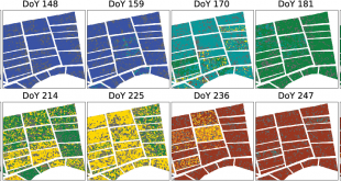
IEEE JOURNAL OF SELECTED TOPICS IN APPLIED EARTH OBSERVATIONS AND REMOTE SENSING, cilt.9, sa.6, ss.2509-2519, 2016 Paddy-Rice Phenology Classification Based on Machine-Learning Methods Using Multitemporal Co-Polar X-Band SAR Images Çağlar Küçük; Gülşen Taşkın; Esra Erten Abstract: Crop monitoring and phenology estimation based on the satellite systems have become an important …
Devamını Oku..Rethinking CNN-Based Pansharpening: Guided Colorization of Panchromatic Images via GANs
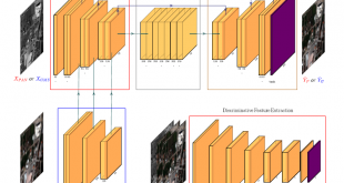
IEEE Transactions on Geoscience and Remote Sensing, : IEEE Transactions on Geoscience and Remote Sensing Print ISSN: 0196-2892 Online ISSN: 1558-0644 Digital Object Identifier: 10.1109/TGRS.2020.3010441. Rethinking CNN-Based Pansharpening: Guided Colorization of Panchromatic Images via GANs F. Ozcelik, U. Alganci, E. Sertel and G. Unal Abstract: Convolutional neural network (CNN)-based approaches …
Devamını Oku..Comparative Research on Deep Learning Approaches for Airplane Detection from Very High-Resolution Satellite Images
Remote Sensing, Vol. 12, No. 3, 458, 2020 Comparative Research on Deep Learning Approaches for Airplane Detection from Very High-Resolution Satellite Images U. Alganci, M. Soydas, E. Sertel Abstract: Object detection from satellite images has been a challenging problem for many years. With the development of effective deep learning algorithms …
Devamını Oku..Soil salinity analysis of Urmia Lake Basin using Landsat-8 OLI and Sentinel-2A based spectral indices and electrical conductivity measurements
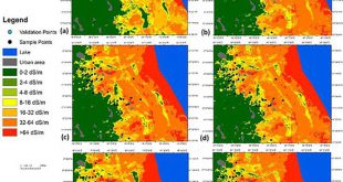
Volume 112, May 2020, 106173 Soil salinity analysis of Urmia Lake Basin using Landsat-8 OLI and Sentinel-2A based spectral indices and electrical conductivity measurements T. Gorji, A. Yildirim, N. Hamzehpour, A. Tanik, E. Sertel Abstract: Soil salinization is one of the significant soil degradation problems especially faced in arid and …
Devamını Oku..ASTER spectral band ratios for lithological mapping: a case study for measuring geological offset along the Erkenek Segment of the East Anatolian Fault Zone, Turkey
Arabian Journal of Geosciences 13 (17), 1-8 ASTER spectral band ratios for lithological mapping: a case study for measuring geological offset along the Erkenek Segment of the East Anatolian Fault Zone, Turkey A. Khalifa, Z. Çakır, Ş. Kaya, S. Gabr Abstract: The current work examines the lithological variation along the …
Devamını Oku..Separating Built-Up Areas from Bare Land in Mediterranean Cities Using Sentinel-2A Imagery
Remote Sensing, 2019, 11, 345 Separating Built-Up Areas from Bare Land in Mediterranean Cities Using Sentinel-2A Imagery Ettehadi Osgouei, P., Kaya, Ş., Sertel, E., Alganci, U. Abstract: In this research work, a multi-index-based support vector machine (SVM) classification approach has been proposed to determine the complex and morphologically heterogeneous land …
Devamını Oku..Vineyard Site Suitability Analysis by use of Multi-Criteria Approach Applied on Geospatial Data
Geocarto International, 34(12), 1286-1299 Vineyard Site Suitability Analysis by use of Multi-Criteria Approach Applied on Geospatial Data Alganci, U, Kuru, G, Algan, I. Sertel, E. Abstract: In this research, multicriteria decision analysis with pairwise comparison weighting method was utilized to determine the suitable locations for vineyard plantation in Sarkoy region …
Devamını Oku..Impacts of Land Cover/Use Changes on Hydrological Processes in a Rapidly Urbanizing Mid-latitude Water Supply Catchment
Water 2019, 11(5), 1075. -SCI Impacts of Land Cover/Use Changes on Hydrological Processes in a Rapidly Urbanizing Mid-latitude Water Supply Catchment Sertel, E.; Imamoglu, M.Z.; Cuceloglu, G.; Erturk, A. Abstract: This research aimed to evaluate the impact of land cover/use changes on watershed responses and hydrological processes by applying the …
Devamını Oku..Evaluation of the Relative Tectonic Activity of the Adıyaman fault within the Arabian-Anatolian plate boundary (eastern Turkey)
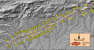
Geologica Acta, DOI: 10.1344/GeologicaActa2019.17.6, 17-6, 1-17, (2019) Evaluation of the Relative Tectonic Activity of the Adıyaman fault within the Arabian-Anatolian plate boundary (eastern Turkey) Khalifa, A., Çakır, Z., Owen, L., Kaya, Ş. Abstract: The left-lateral strike-slip Adıyaman fault is located in eastern Turkey within the plate boundary deformation zone between Arabia …
Devamını Oku..Calculation of Flood Risk Index for Yesilirmak Basin-Turkey
International Journal of Environment and Geoinformatics (IJEGEO), 6(3): 244-259 Calculation of Flood Risk Index for Yesilirmak Basin-Turkey Menteş E., Kaya, S., Tanik, A., Gazioglu, C. Abstract: Flood risk, in the sense of damage that a ‘flood event’ can cause, was globally indexed and quantified to show the relationship between various …
Devamını Oku.. UHUZAM İTÜ – Uydu Haberleşme ve Uzaktan Algılama UYG-AR Merkezi