International Journal of Remote Sensing, Volume 42, 2021 – Issue 19, Pages 7239-7269
Object-based modelling and accuracy assessment of Gordion tumuli using very high-resolution stereo satellite images
Mehmet Doğruluk, Mustafa Yanalak
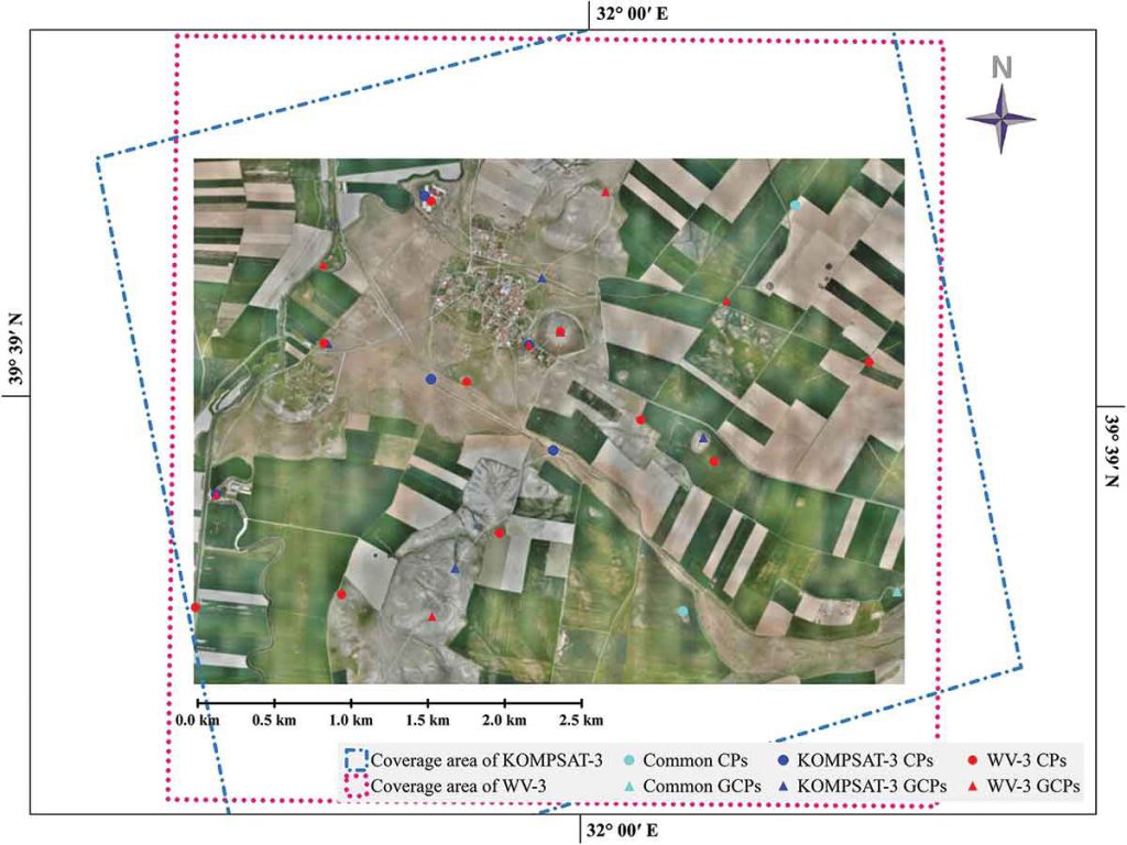
Abstract: Very high-resolution (VHR) stereo satellite images provide detailed spatial and spectral information for detecting and monitoring artificial or natural objects. This information can also be used for object-based change detection. This study aims to reveal the potential of three-dimensional (3D) information generated from VHR stereo satellite images to determine the physical changes that may occur on Gordion tumuli. For this purpose, point cloud data were generated from WorldView-3 and KOMPSAT-3 stereo satellite images. The accuracy of these datasets was tested using 161 check points (CPs). On the other hand, digital surface models (DSMs) generated from VHR stereo satellite images were used for object-based modelling of tumuli. The vertical accuracy of these DSMs was tested by comparing them with reference DSMs extracted from Unmanned Aerial System (UAS) images. As a result of the vertical accuracy assessment of the point cloud data, 0.16 m and 0.53 m root mean square error (RMSE) values were obtained for WorldView-3 and KOMPSAT-3 data, respectively. The average RMSE values obtained as a result of the model-based comparison of DSMs are 0.28 m for WorldView-3 and 0.57 m for KOMPSAT-3. These results demonstrate that the sub-metre level physical changes occurring on tumuli can be determined by VHR stereo satellite images.
Available Online: https://www.tandfonline.com/doi/full/10.1080/01431161.2021.1954258