
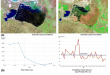
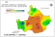
On February 6, two major earthquakes of 7.4 and 7.8 in magnitude hit city of …
Read More..-
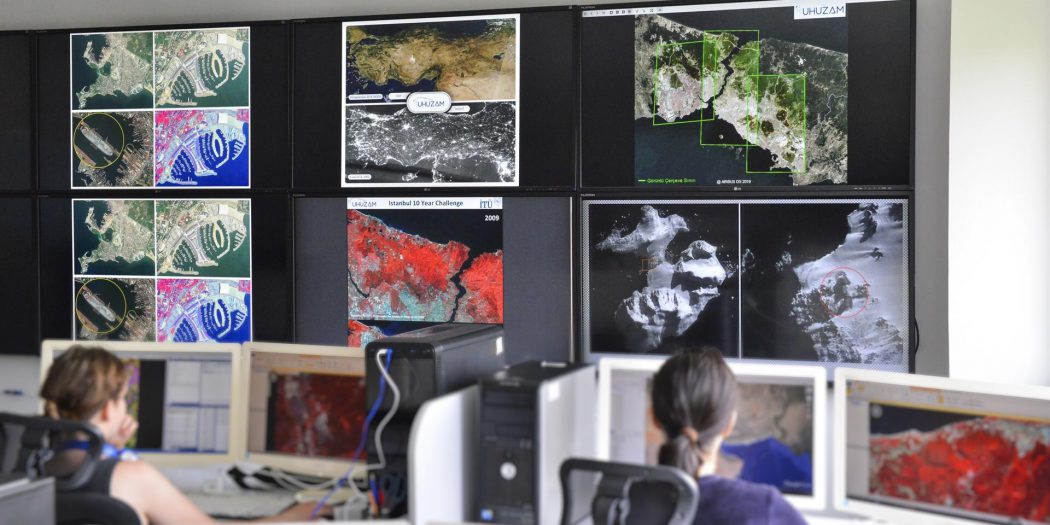
ITU - CSCRS
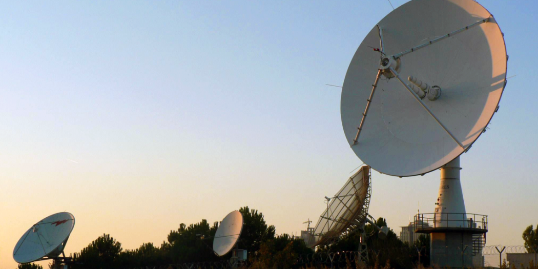
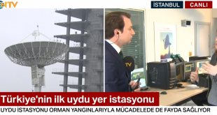
ITU - CSCRS, Turkey's first satellite ground station
-
ITU - CSCRS
Remote sensing and satellite communications issues in technological projects conducted the first center in Turkey
-
ITU - CSCRS
GREATEST can directly download data from different satellites and satellite image archive with a single center in Turkey
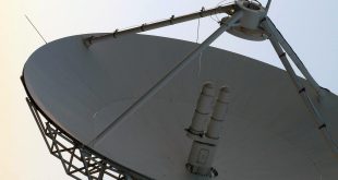
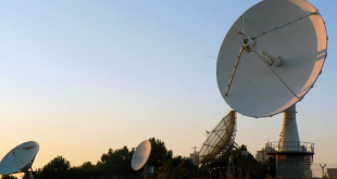
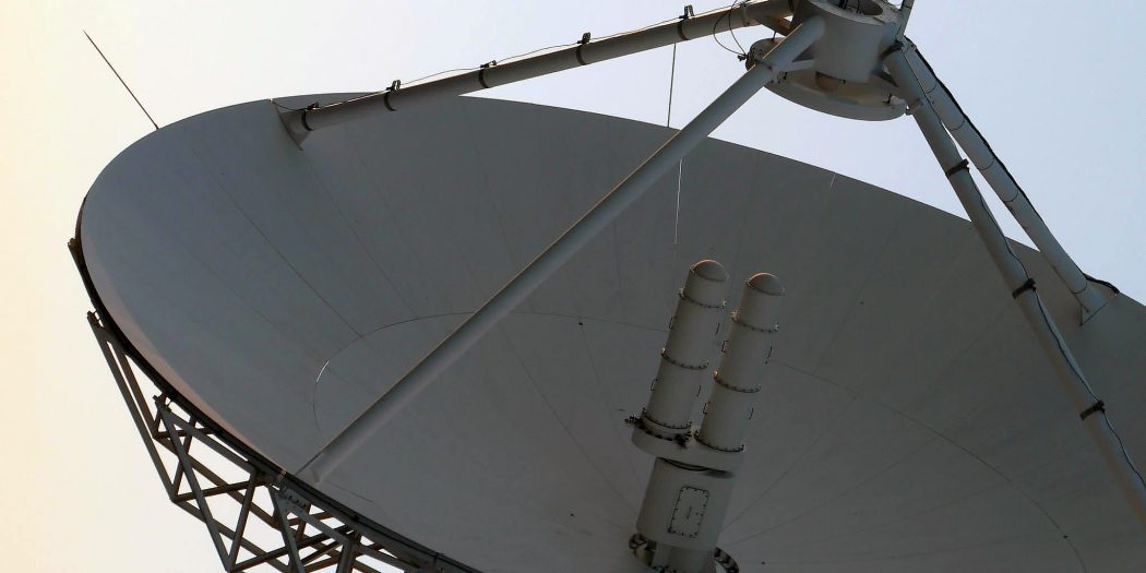
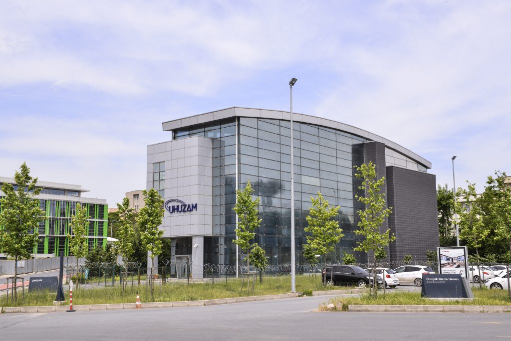
ITU - Satellite Communication and Remote Sensing Center
ITU UHUZAM is one of the rare university centers in the world that has a satellite ground station. In Turkey is the first satellite ground station. In addition, it is the first center to carry out technological projects on remote sensing and satellite communication.
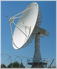
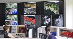
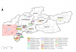
Image Coverage
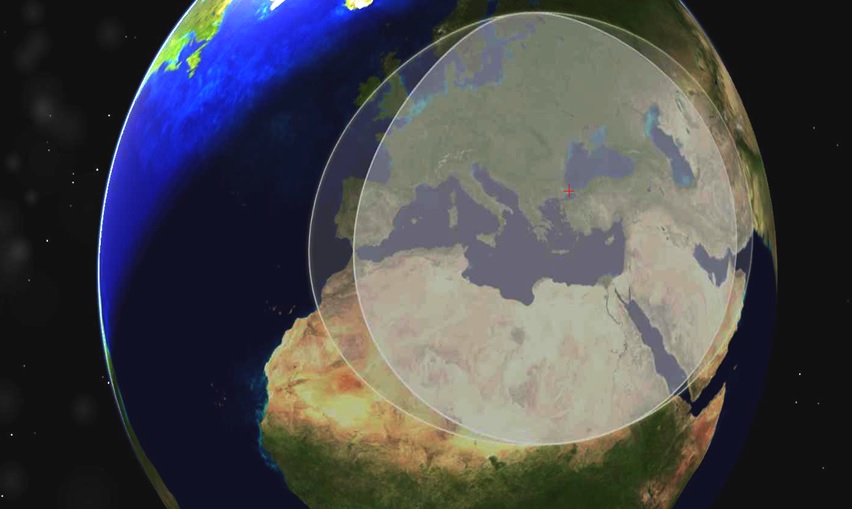
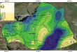
ITU UHUZAM has 2.4m and 4.6m diameter VSAT antennas to receive data from Ku band communication satellites, 13 m diameter remote sensing antenna and up to 3000 km diameter coverage area with X-band remote sensing satellites reception capabilities (From Sweden in the north to Sudan in the south from England in the west to Kazakhstan in the east).
ITU CSCRS from mid-2002 to present satellite remote sensing, high and very high resolution data acquisition performs CSCRS APPL-R has Turkey's largest satellite image archive. In ITU CSCRS archive, Radarsat 1 for the period 2002-2012, ERS-2 for the 2002-2005 period, NOAA 14,15,16,17, Spot 2 for the 2002-2009 period and Spot 4 for the 2002-2013 period, from 2009 There are images of Spot 5 satellite today and Spot 6 satellite from 2011 to the present. Telemetry agreements for Spot 7 and Pleiades 1A & 1B satellites have been concluded and image archiving has been started since March 2014.
ITU CSCRS
With the management staff of our center, the advisory board and the experienced master / doctorate educated staff in remote sensing, image processing, geographical information system, satellite communication, system and network, working on a permanent / contract basis:
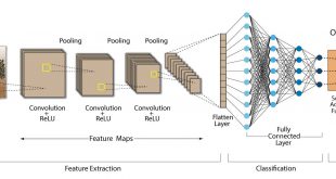
- Receiving data from remote sensing satellites with a spatial resolution of 0.5 - 10 m and processing satellite images at different levels,
- Delivery of processed images or value-added products to national / international users via satellite links and fiber internet,
- It operates in the fields of remote sensing and computer technologies, organizing and conducting national-international research and application projects and training programs.
-
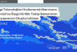
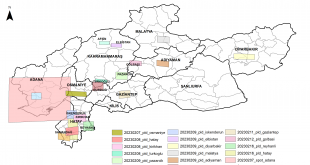
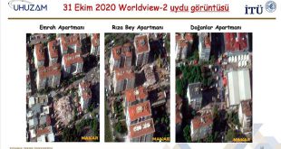
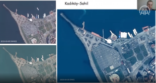
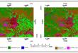
Satellite images shared with researchers by ITU-CSCRS to support scientific research after Kahramanmaraş Earthquakes
-
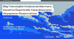
Workshop of the Project “Building the Infrastructure of the Pollution Monitoring System Specific to the Sea of Marmara Using Information Technologies” Supported by Tübitak
-
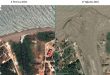
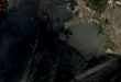
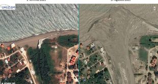
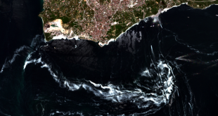
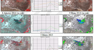
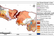
ITU-CSCRS Detected the Destruction of the Flood Disaster from Satellite
-
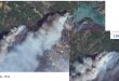
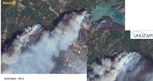
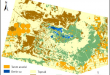
ITU-CSCRS Detects Damage Caused by Forest Fires from Satellite
-
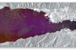
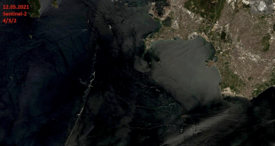
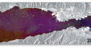
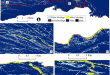
It was determined that the mucilage was cleared in the images of the Marmara Sea taken from space.
-
Distribution of Mucilage and Ship Mobility in the Gulf of Izmit from Sentinel-1 SAR Images

-
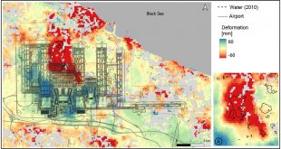
Assessing spatio-temporal dynamics of large airport’s surface stability
GEOCARTO INTERNATIONAL 2022, AHEAD-OF-PRINT, 1-14 Assessing spatio-temporal dynamics of large airport’s surface stability Nur Yağmur, Esra Erten, Nebiye Musaoğlu, ve Erdal Şafak Abstract: …
Read More.. -
Detection of mucilage phenomenon in the Sea of Marmara by using multi‑scale satellite data
-
Development of sustainable wetland management strategies by using the analytical hierarchy process and web-based GIS: A case study from Turkey
-
Evaluating Drought Events by Time-Frequency Analysis: A Case Study in Aegean Region of Turkey
-
Object-based modelling and accuracy assessment of Gordion tumuli using very high-resolution stereo satellite images
-
Sulak alanların uzaktan algılama ve coğrafi bilgi sistemleri ile irdelenmesi: Akgöl örneği
Fen Bilimleri Enstitüsü, Geomatik Mühendisliği Programı, İTÜ Sulak alanların uzaktan algılama ve coğrafi bilgi sistemleri …
Read More.. -
Başlıca iklim parametrelerinin bitki su tüketimine etkilerinin uzaktan algılama yöntemleri ile araştırılması
-
CORINE sınıflandırmasının Sazlıdere havzası ölçeğinde tematik doğruluk analizi
-
Sündiken kütlesi’ndeki yükselti-iklim kuşaklarının ve orman toplumlarının özelliklerinin uydu görüntüleri ile belirlenmesi
-
Aktif uzaktan algılama verileri ve CBS destekli hidrolojik model kullanılarak Büyükçekmece havzasının incelenmesi
-
Vessel Detection From Very High-Resolution Satellite Images With Deep Learning Methods
İletişim Sistemleri Anabilim Dalı, Uydu Haberleşmesi ve Uzaktan Algılama Programı, İTÜ Vessel Detection From Very …
Read More.. -
Farklı sınıflandırma algoritmaları kullanarak sentinel-2 ve landsat 8 verileri sınıflandırması ve tematik doğruluk değerlendirmesi (Silifke ilçesi örneği)
-
İstanbul kuzey ormanlarında zamansal ve mekansal değişimlerin uydu görüntüleri ve peyzaj metrikleri ile analizi
-
Akgöl Sulak Alanı’nın yüksek çözünürlüklü uydu görüntüleri ile incelenmesi
-
Ramsar alanlarının uzaktan algılama yöntemleri ile zamansal analizi – meke maarı örneği