Projects

Ongoing Projects

Development of a Next-Generation AI-Based Damage Assessment System for Electrical Infrastructure Using Satellite Imagery and SAR Data Immediately After Natural Disasters

This project, supported by the Energy Market Regulatory Authority of Türkiye (EPDK) and carried out in collaboration with Istanbul Technical University, BEDAŞ, SEDAŞ, AYEDAŞ, TREDAŞ, UEDAŞ, and private sector stakeholders, aims to enable rapid and accurate post-disaster damage detection using remote sensing data with various spatial resolutions, powered by artificial intelligence. Pilot areas were selected in the Marmara Region, including Sümer Neighborhood in Zeytinburnu (BEDAŞ), Kadıköy district center (AYEDAŞ), Osmangazi district center (UEDAŞ), Darıca Neighborhood in Gebze (SEDAŞ), and Süleymanpaşa district center (TREDAŞ). Within the scope of the project, two open-source models were developed: KATE-CD (Change Detection), which allows for detecting changes and damages by comparing pre- and post-disaster satellite imagery, and KATE-PD (Pre-Disaster), which facilitates vulnerability and risk assessment of electrical infrastructure before a disaster. Both models are accessible via the following links:

GitHub:

  • https://github.com/CSCRS/kate-cd
  • https://github.com/CSCRS/kate-pd

Hugging Face:

  • https://huggingface.co/datasets/CSCRS/kate-cd
  • https://huggingface.co/datasets/CSCRS/kate-pd

Code Ocean:

  • https://codeocean.com/capsule/8064452/tree/v1
  • https://codeocean.com/capsule/9061546/tree/v1
 

Completed Projects

Development of an Information Technology-Based Pollution Monitoring Infrastructure Specific to the Sea of Marmara (121Y142)

The project funded by TÜBİTAK and completed in August 2022 was developed to provide a solution to the marine mucilage problem, which has increased its impact especially in recent years in the Sea of Marmara. Within the scope of the project, all environmental factors affecting the marine ecosystem were addressed with an interdisciplinary and holistic approach. In this context, geographical data such as satellite imagery, aerial photographs, marine and hydrological measurements, meteorological parameters, various local data related to pollution sources, and the spatial distribution of industrial facilities were analyzed together. These multi-layered datasets obtained from different sources were integrated into a Geographic Information System (GIS) infrastructure and visualized on a web-based platform, making it accessible to users. The developed system enables not only the monitoring of the current status but also the tracking of spatial and temporal changes in pollution trends, identification of high-risk areas, and contribution to decision-support processes. The project outputs were shared with relevant institutions and local governments, and an online workshop was held to provide information on the use of the system and to conduct a feedback process. As a result, a comprehensive and sustainable infrastructure platform has been established, enabling the production of pollution scenario maps specific to the Sea of Marmara, the early detection of critical problems such as mucilage, and data sharing among stakeholders.

Satellite-Based Sensitivity/Vulnerability and Risk Analysis in Forest Fires: The Case of Antalya

This study, conducted within the scope of the Scientific Research Project (BAP) of Higher Education Institutions and completed in January 2024, investigated the forest fires that occurred in the Manavgat district of Antalya in July/August 2021 and their impacts. A comprehensive analysis was carried out to identify the risks posed by forest fires, particularly in areas close to residential zones, in advance. Within the scope of the project, satellite imagery, aerial photographs, forest road networks, fire brigade response points, land morphology (such as slope and aspect), climatic data, and social, demographic, and economic factors were integrated into a Geographic Information System (GIS) infrastructure. Through integrated spatial data analysis, sensitivity and vulnerability to fires were assessed, and risk levels were calculated using the Fuzzy Analytic Hierarchy Process (Fuzzy AHP) method. A web-based GIS application was developed to serve as a decision-support tool for preventive measures before fires and to provide a dynamic infrastructure that contributes to fire management processes. By combining satellite-derived data with other necessary datasets for risk assessment, analyses of fire spread direction and vulnerability were conducted. As a result of the project, the use of information technologies contributed to strengthening preparedness and response capacity against potential disasters.

Publishing the Kahramanmaraş Earthquakes via a Web-Based GIS Application

Following the major earthquakes that occurred on February 6, 2023, in southeastern Türkiye and affected multiple provinces, a web-based geographic information system (GIS) application was provided to users to enable rapid and effective execution of search and rescue operations, damage assessment, and scientific research. This study, covering the provinces of Kahramanmaraş, Kilis, Malatya, Gaziantep, Hatay, Diyarbakır, Elazığ, Adıyaman, Osmaniye, Adana, and Şanlıurfa, utilized emergency tasking of Earth observation satellites to obtain high-resolution satellite imagery. Damage assessment analyses were conducted on collapsed buildings using these post-earthquake images, and the geometries of the damaged structures were converted into vector data. Additionally, pre-earthquake satellite imagery was acquired and integrated into the system to enable comparative analysis. The developed application allows users to compare pre- and post-earthquake images and to examine collapsed buildings and their geometries in detail. All these datasets were made openly and freely accessible to institutions and organizations involved in disaster management, as well as to researchers and students, ensuring fast and easy access to information via a web map service. Serving as a decision-support tool in post-earthquake response processes, this system was developed as a model application demonstrating the effectiveness of spatial data technologies in disaster management.

Agricultural Information System Project

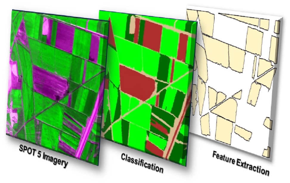
Developed for the Tatarhöyük Irrigation Union and completed in September 2023, this project integrated high-resolution remote sensing data and geographic information system (GIS) technologies to monitor agricultural lands, identify crop patterns, and support data-driven decision-making processes. Through the processing of satellite imagery, the distribution of agricultural crops such as corn, cotton, and cereals was analyzed, and the areas covered by these crops were converted into vector data for precise calculations. Along with production areas, detailed administrative information including province, district, neighborhood, map sheet, block, and parcel was integrated into the system, enabling the identification of which crops are cultivated and how much area they cover on a specific parcel. The developed web-based GIS application provided advanced features such as drawing, measurement, address queries, and working with various base maps, enhancing the user experience. The application was designed to be mobile-compatible, allowing field personnel to access data quickly and efficiently using tablets and smartphones without issues. A user-centered decision-support system was developed that facilitates the monitoring of agricultural lands, ensures accurate analysis of crop patterns, and directly supports field operations.

Development of the Data Cube for the UDENE – Urban Development Explorations Using Natural Experiments Project

The Urban Development Explorations Using Natural Experiments (UDENE) project is an international collaboration funded under the European Union’s Horizon Europe / EUSPA program, offering a research framework based on natural experiments to support urban development. Within the scope of the project, a data cube infrastructure was developed to systematically store, analyze, and visualize high-volume Earth Observation (EO) data obtained primarily from Copernicus satellite systems and local sources. Satellite imagery provided by project partners and open data providers was standardized by converting it into Analysis Ready Data (ARD) formats and integrated into the data cube. The developed system offers multi-dimensional querying and time-series-based analysis capabilities, providing a dynamic working environment for researchers and developers. Through this infrastructure, users can directly perform analyses on different datasets, visualize results spatially, and evaluate urban dynamics with a more holistic approach.

Agricultural Monitoring and Information System (TARBIL)

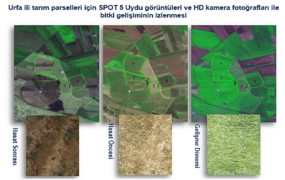
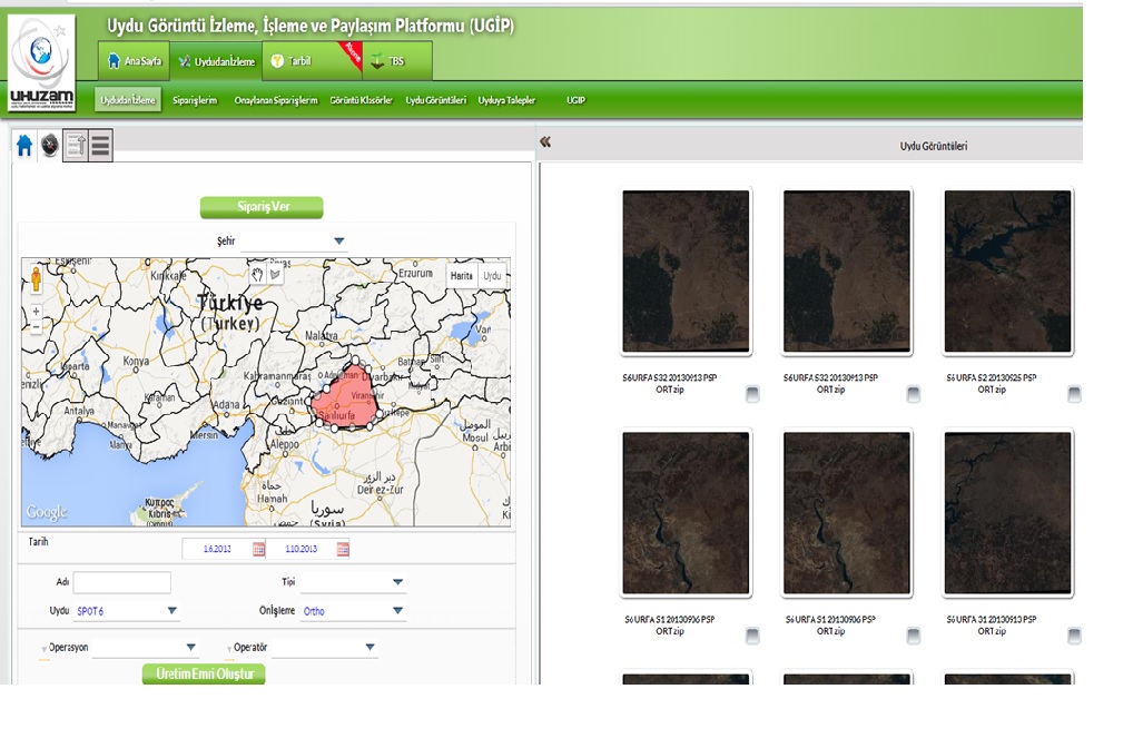
CSCRS; ​​Within the scope of the Agricultural Monitoring and Information System (TARBIL) project, it carries out the periodic monitoring of cultivated areas with high spatial resolution satellite images during the phenological period, the determination of product types and spatial distribution with object-based image classification, the production of plant indices for monitoring product development, the transfer of the produced image, classification and plant index data and statistical result reports to the relevant units affiliated to the Ministry of Food, Agriculture and Livestock. With its 600 TB online data storage server and fast fiber network infrastructure, CSCRS shares the data with the help of UGİP and PARİS modules integrated with the TARBIL web interface. With UGIP, which is a satellite image sharing platform, the end user can perform archive scanning with the selected satellite type and image processing level information in the relevant geographical area, within the specified date range, and can download the images he/she has determined with multiple selection among the results via the web interface. Thanks to the PARIS platform, the end user can view the current satellite images, plant index data, and product planting pattern information as layers on the agricultural parcels/parcels that he/she is interested in or owns via mobile devices or standard computers. In addition, authorized GTHYB personnel can perform terrestrial data entry, association with satellite image-based data and verification processes on a parcel basis during field studies and update the database.

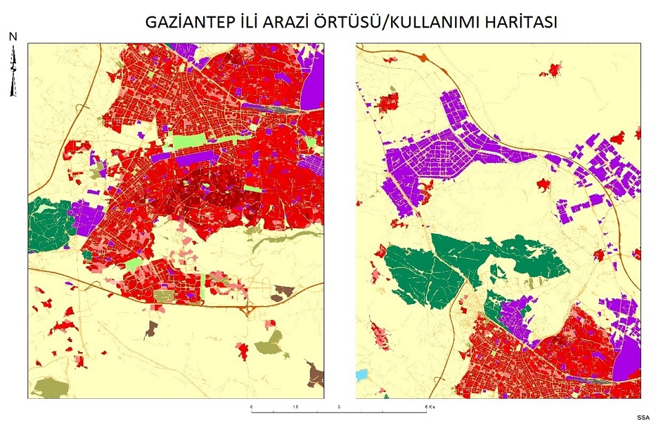
Creation of a National Land Cover Database

Developing a national land cover/use classification system using high spatial resolution satellite images and proposing an appropriate methodology in this context.
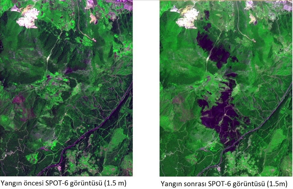
Post-Forest Fire Damage Assessment Analysis with Spot 6 Images

Detection of fire affected areas by near real-time Spot 6 image acquisition and object-based classification after the fire and determination of damaged species by comparing with the stand map.

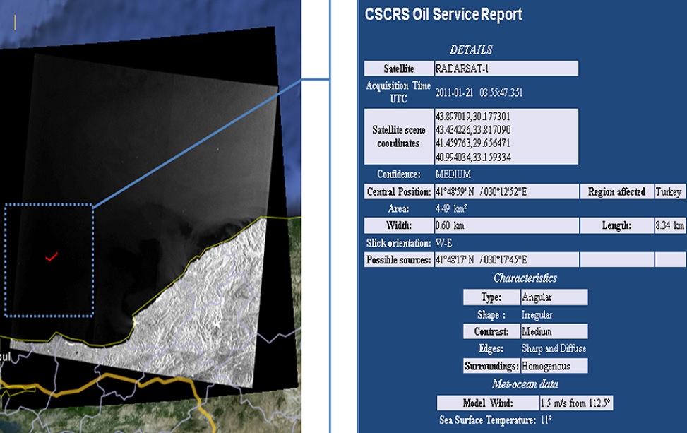
Detection of Ship-Sourced Pollution with Radar Images

Detection of ship-sourced pollution in the open seas and reporting to relevant units thanks to the ability to download near real-time images directly to the center and rapid analysis (30 min.).


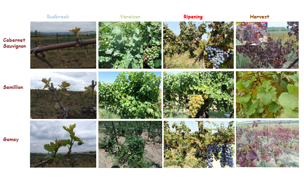
Determination of Vineyard Areas with Remote Sensing and GIS

Determination of spatial distribution of vineyard areas in Tekirdağ province with satellite images and ground measurements, creation of grape spectral libraries and determination of grape varieties and determination of suitable areas for viticulture with the help of this library from high-resolution satellite images.


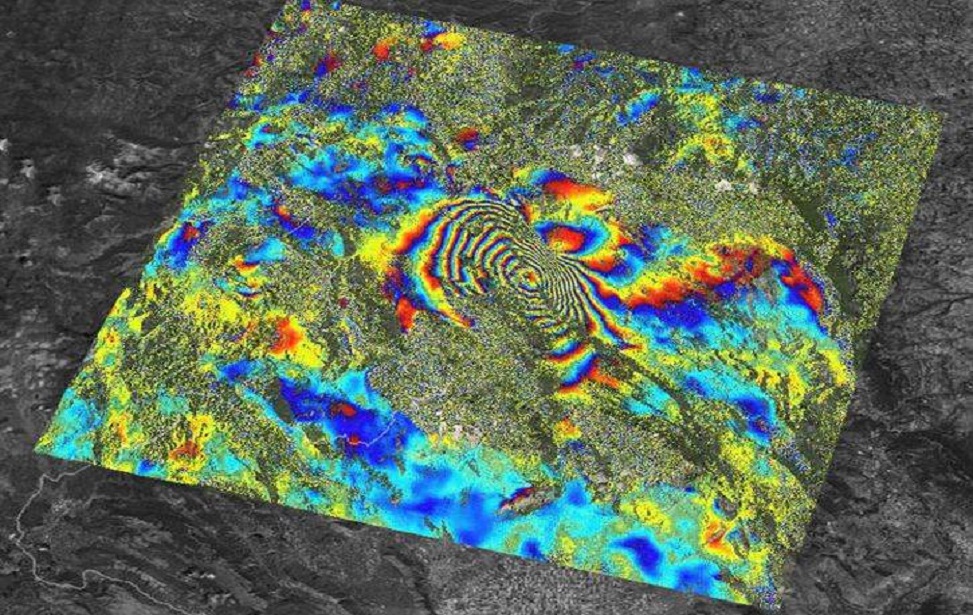
Italy – INSAR Project

Radarsat 1 images used to determine deformation in mining areas in Italy were provided by CSCRS.
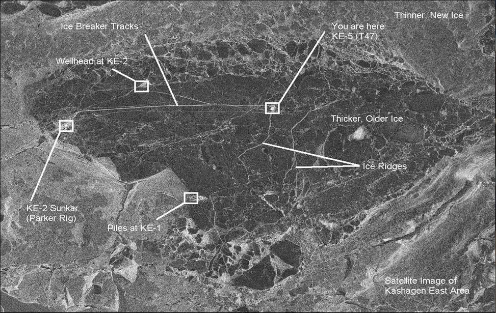
 

Caspian sea ice monitoring

Ice movement monitoring among the oil rigs at Caspian sea


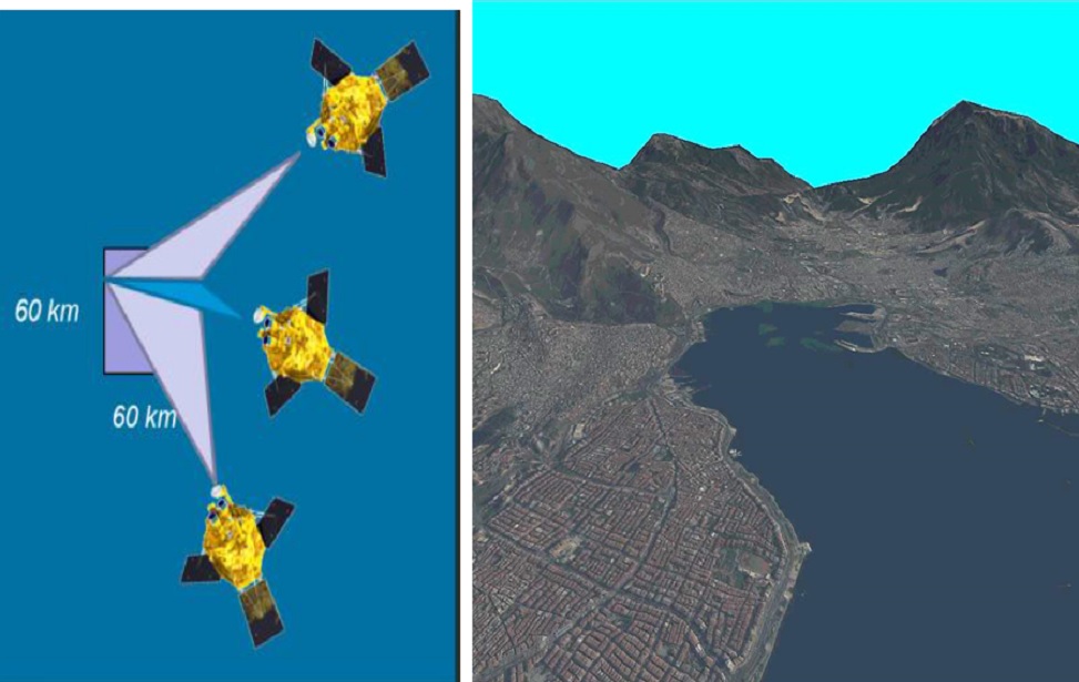
Digital Terrain Model Generation Using Spot 6 Tri-Stereo Imagery

Generating a Digital Terrain Model using tri-stereo satellite imagery from Spot 6 and Pleiades satellites.


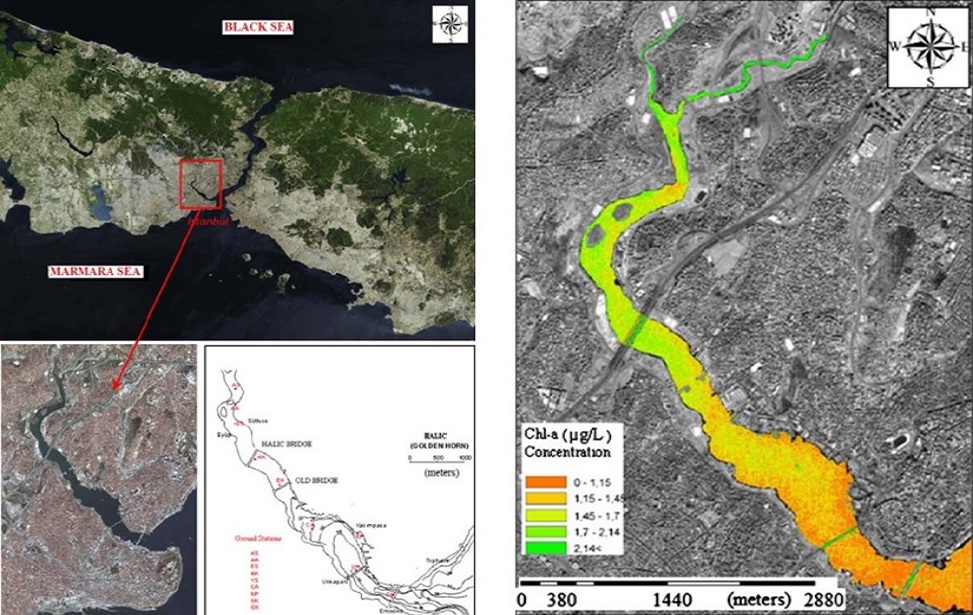
Water Quality Analysis with Satellite Images – Golden Horn Example

Determination of water quality and spatial distribution of pollutants in the Golden Horn using satellite images and simultaneous ground measurements.
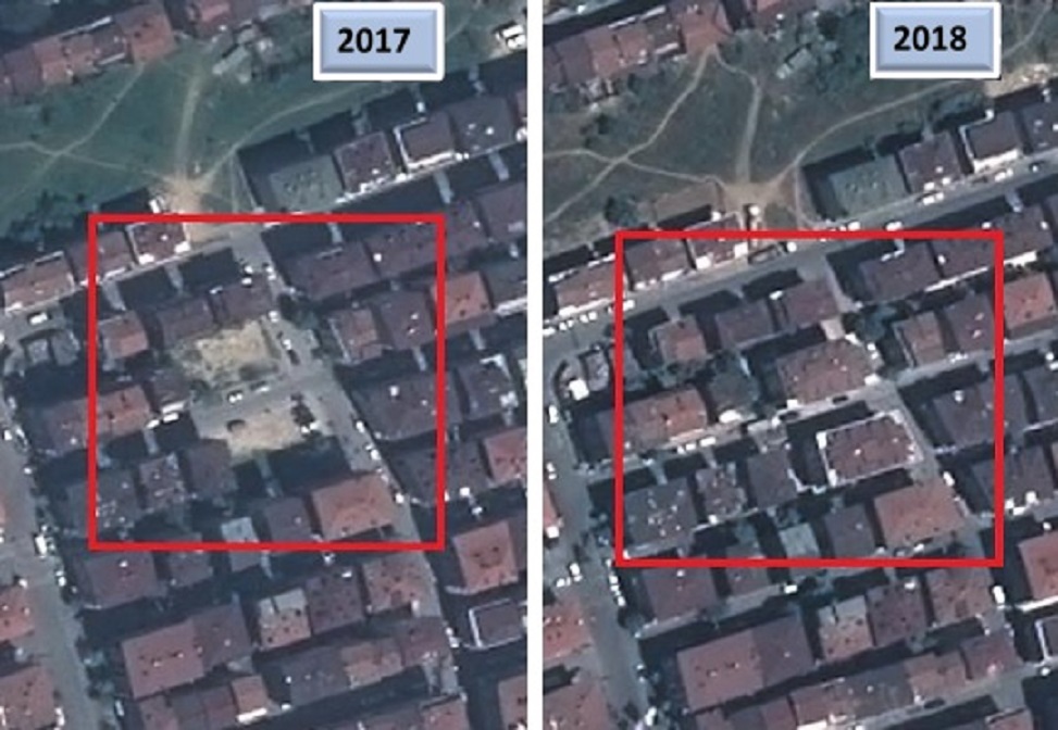
 

Zoning Peace – Building Change Detection

The application of determining building changes is carried out with Pleiades 1A&1B satellites.

 
CSCRS