Istanbul Technical University (ITU) Satellite Communication and Remote Sensing Application and Research Center (CSCRS) viewed the destruction caused by the flood disaster in the Western Black Sea region from space.
ITU CSCRS Director and ITU Civil Faculty Geomatics Engineering Department Head Prof. Dr. Mustafa Yanalak stated that there are significant damages on bridges, buildings and roads in satellite images.
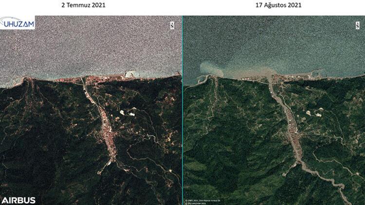
Istanbul Technical University (ITU) Satellite Communication and Remote Sensing Application and Research Center (CSCRS), Turkey’s first satellite earth station, has viewed the destruction caused by the flood disaster in the Western Black Sea region, which killed 81 people, from space. In the examinations, the images before and after the flood were compared.
Saying that as CSCRS, they can provide satellite images of the flood region, ITU UHUZAM Manager and ITU Civil Faculty Geomatics Engineering Department Head Prof. Dr. Mustafa Yanalak made the following statements; “As the Satellite Communication and Remote Sensing Application and Research Center, we conducted a study on the damage caused by the flood disaster with high resolution satellite images. We saw the effects of the flood disaster very clearly in the images. The flood disaster occurred in different regions of the Black Sea, but mostly Bozkurt and Abana. There were also casualties and damages in the regions,” he said.
‘HALF OF THE RAIN THAT WOULD FALL IN A YEAR FELL IN A SHORT TIME LIKE 2-3 DAYS’
Prof. Dr. “Especially due to climate change, the distribution of precipitation has changed. Especially in Bozkurt and Abana regions, half of the precipitation that will fall in a year has fallen in a short period of 2-3 days. As such, serious property and life losses have occurred. We can see this situation very clearly in satellite images.” he said.
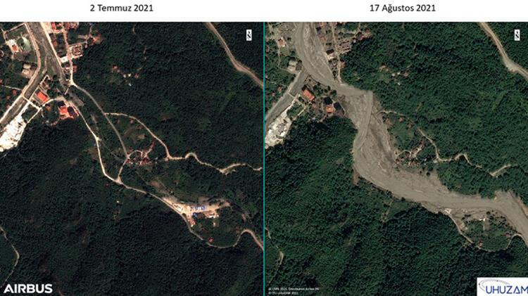
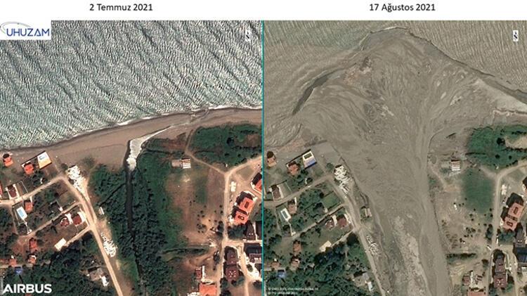
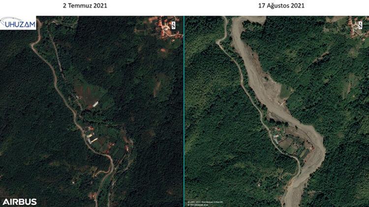
‘REAR BED SPREADED UP TO 300-350 METERS AFTER FLOOD’
Stating that there are significant damages on bridges, buildings and roads in satellite images, Prof. Dr. Yanalak said, “We can see that a delta has formed in the Abana region. Again, we can see that the materials that can be transported throughout the entire basin were transported and piled up with the flood. The stream bed, which was 30 meters wide, spread up to 300-350 meters after the flood. Again, we detected many collapsed buildings and bridges here. We can clearly see that areas such as green areas and football fields are completely lost and flooded,” he said.