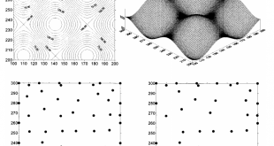
JOURNAL OF SURVEYING ENGINEERING-ASCE, Vol. 129, No. 2, 2003, s. 56-64, ISSN: 0733-9453 Digital Elevation Model Based Volume Calculations Using Topographical Data M.Yanalak, O.Baykal Abstract: Volume calculations based on a digital elevation model (DEM) are widely used instead of traditional handmade cross-sectioning methods on contour maps. Cross sections can be …
Read More..Transformation of ellipsoid heights to local leveling heights
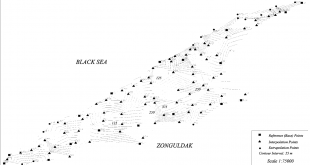
JOURNAL OF SURVEYING ENGINEERING-ASCE, Vol. 127, No. 3, 2001, s. 90-103, ISSN: 0733-9453 Transformation of ellipsoid heights to local leveling heights M. Yanalak, O. Baykal Abstract: The aim of this study is to evaluate the use of interpolation methods, which are used for digital terrain modeling, in transformation of Global …
Read More..FDTD Evaluation of the SAR Distribution in a Human Head Near a Mobile Cellular Phone
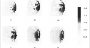
Turkish Journal of Electrical Engineering & Computer Sciences 6 (3), 227-242 FDTD Evaluation of the SAR Distribution in a Human Head Near a Mobile Cellular Phone L. Sevgi, S. Paker Abstract: In this study, Finite-Difference Time-Domain (FDTD) method is used to calculate the Specific Absorbtion Rate (SAR; defined as the power …
Read More..Detecting of Lithological Units by Using Terrestrial Spectral Data and Remote Sensing Image
Journal of the Indian Society of Remote Sensing, 45(2), 259-269. (2017) Detecting of Lithological Units by Using Terrestrial Spectral Data and Remote Sensing Image Gürsoy, Ö., Kaya, Ş Abstract: The objective of the study was to carry out an automatic classification of the lithological units of interest using the integration …
Read More..Evaluation of spatio temporal variability in Land Surface Temperature A case study of Zonguldak Turkey
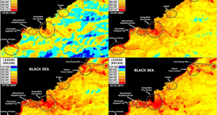
Environmental Monitoring and Assessment, Vol. 188, No. 1, Ocak 2016, ISSN: 0167-6369 Evaluation of spatio temporal variability in Land Surface Temperature A case study of Zonguldak Turkey Şekertekin Ali İhsan, Kutoğlu Şenol Hakan and Kaya Şinasi Abstract: The aim of this study is to analyze spatio-temporal variability in Land Surface …
Read More..Comparison of pixel and object based classification approaches for Burned Area Mapping using SPOT-6 images
Geomatics, Natural Hazards and Risk, 7, 4, DOI:10.1080/19475705.2015.1050608, 1198-1206 Comparison of pixel and object based classification approaches for Burned Area Mapping using SPOT-6 images Sertel, E. and Alganci, U Abstract: On 30 May 2013, a forest fire occurred in Izmir, Turkey causing damage to both forest and fruit trees within …
Read More..The role of spatial analysis for aquaculture: a case study of Keban Dam lake
Fresenius Environmental Bulletin, 26(1), 405-412. (2017) The role of spatial analysis for aquaculture: a case study of Keban Dam lake Sivri, N., Seker, D.Z., Alganci, U., Basusta, N., Basusta, A., Akgun, H Abstract: Turkey is divided into 25 hydrologic basins depending on the topographic structure. These basins have different productivities …
Read More..Analysis of Land Cover/Use Changes Using Landsat 5 TM Data and Indices
Environmental Monitoring and Assessment, 189(4), Article Number: 136, DOI 10.1007/s10661-017-5818-5. (2017) Analysis of Land Cover/Use Changes Using Landsat 5 TM Data and Indices Ettehadi Osgouei, P., Kaya, Ş. Abstract: Urban expansion and unprecedented rural to urban transition, along with a huge population growth, are major driving forces altering land cover/use …
Read More..A Comparative Analysis of Classification Methods for Hyperspectral Images Generated with Convential Dimension Reduction Methods
Turkish Journal Of Electrical Engineering & Computer Sciences, 25 (1), 58-72. (2017) A Comparative Analysis of Classification Methods for Hyperspectral Images Generated with Convential Dimension Reduction Methods Arslan, O., Akyurek, Ö., Kaya, Ş. Abstract: This paper compared performances of classification methods for a hyperspectral image dataset in view of dimensionality …
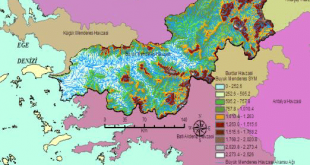
Read More..Investigation Of Morphometric and Hydrological Characteristics of a Water Basin Using Numerical Models
Fresenius Environmental Bulletin, 26 (1), 360-368. (2017) Investigation Of Morphometric and Hydrological Characteristics of a Water Basin Using Numerical Models Kaya, Ş., Kutukcu, A Abstract: Defining the characteristics of a basin is extremely important in terms of its maximum utilization rate. Impact of the basin structure and morphological characteristics on the hydrological processes is essential during conducting a research on a …
Read More.. CSCRS İTÜ – Center for Satellite Communications and Remote Sensing