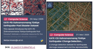
On February 6, two major earthquakes of 7.4 and 7.8 in magnitude hit city of Kahramanmaraş, Turkey. The first earthquake occurred at 4:17 am, and the second struck 9 hours later at 01:24 pm. The earthquakes had a catastrophic impact on eleven cities in Turkey and multiple regions in Syria, resulting in the loss of tens of thousands of lives and the displacement of millions of people. Following the earthquakes, diverse remote sensing datasets1, such as optical, SAR, drone images, etc., some acquired pre-and post-event, have been made accessible to the public by multiple providers, with the aim of assessing the extent of earthquake damage, managing disaster coordination, expediting post-disaster reconstruction, and efficiently planning to the rebuilding of the affected cities. Assessing earthquake-induced damage has proven to be a challenging task due to the diverse types of resolution, sensors, platforms, and fields of view of the available images acquired from affected regions. The recent earthquakes have highlighted one more time the crucial role of remote sensing as a source of diverse and abundant data for analyzing and monitoring earthquake-induced damage as well as timely responding to disasters. Remote sensing technologies, such as satellites equipped with optical and synthetic aperture radar (SAR) sensors, as well as airborne systems, have the capability to observe large urban areas and provide vital information for disaster response and mitigation efforts. Despite their advantages, there are still several challenges posed by the diversity of remote sensing images, the extent of affected regions, and the timing of earthquakes that occurred in Turkey. Therefore, initiating such a special issue is especially crucial in ensuring that the GRSS community contributes to the next generation of disaster response in the event of similar disasters in the future.
The broad topics include (but are not limited to):
- Cross-modal change detection
- Multi-sensor alignment
- Data-fusion-based damage detection
- Vulnerability prediction
- Mining contextual features for damage assessment
- Post-earthquake damage assessment using computer vision techniques
- Rapid earthquake damage assessment
- Use of auxiliary data sources, such as GIS, LIDAR, etc., for damage assessment.
Schedule
Apr, 01, 2023 Submission system opening
Mar, 31, 2024 Submission system closing
Format
All submissions will be peer reviewed according to the IEEE Geoscience and Remote Sensing Society guidelines. Submitted articles should not have been published or be under review elsewhere. Submit your manuscript on http://mc.manuscriptcentral.com/jstars, using the Manuscript Central interface and select the “Damage/Risk Assessment for 2023 Turkey Earthquakes using Remote Sensing” special issue manuscript type. Prospective authors should consult the site https://ieeexplore.ieee.org/stamp/stamp.jsp?tp=&arnumber=9082768&tag=1 for guidelines and information on paper submission. All submissions must be formatted using the IEEE standard format (double column, single spaced). Please visit – http://www.ieee.org/publications_standards/publications/authors/author_templates.html to download a template for transactions. Please note that as of Jan. 1, 2020, IEEE J-STARS has become a fully open-access journal charging a flat publication fee $1,250 per paper.
From the articles submitted by authors from the affected regions, a committee formed by the Guest Editors will select at most 10 papers that are outstanding regarding the presentation of the methodology and results, the significance of the contribution, and timeliness of the approach. The processing charges of these selected articles shall be waived.
Dr. Gülşen Taşkın Istanbul Technical University, Turkey (gulsen.taskin@itu.edu.tr)
Dr. Nebiye Musaoğlu Istanbul Technical University, Turkey (musaoglune@itu.edu.tr)
Dr. Esra Erten Istanbul Technical University, Turkey (eerten@itu.edu.tr)
Dr. Ronny Hänsch German Aerospace Center (DLR) (ronny.haensch@dlr.de)
Dr. Lexie Yang Oak Ridge Laboratory, USA (yangh@ornl.gov)
1 Within the context of this special issue, some remote sensing datasets along with ground truth will be made available by ITU-CSCRS (Istanbul Technical University – Research and Application Center for Satellite Communications and Remote Sensing) for research use. For more detail, please visit https://web.cscrs.itu.edu.tr/kahramanmaras-earthquakes/
 CSCRS İTÜ – Center for Satellite Communications and Remote Sensing